System Development
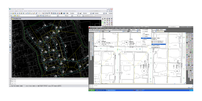
Geographic Information Systems (GIS)
We support system construction for various usage environments.
| Business Fields |
We provide support from design to operation in the fields of water supply, sewerage, disaster, forestry, agriculture, and urban planning. |
|---|---|
| GIS Engine |
We mainly use ArcGIS, but we also use QGIS, which is OSS (Open Source Software). |
| Handling of GIS data | We can handle various types of GIS data. We can handle numerical maps provided by the Geospatial Information Authority of Japan (GSI), Fundamental Geospatial Data, and Denshi Kokudo Tile Data. In addition, it can handle data in GML, KML, SHAPE format, etc. |
| Examples of Development Projects |
|
| Operation and Maintenance | We can provide data maintenance as well as trouble-shooting. |
Introduction consulting
We provide consulting services to companies in various industries and municipalities that are considering the introduction of GIS-based systems for management operations, information organization, etc., and to customers that are considering the migration to Web GIS.
We accept a variety of projects. Please feel free to contact us.
Inquiry Form>
info@pipedesign.co.jp
Development Examples
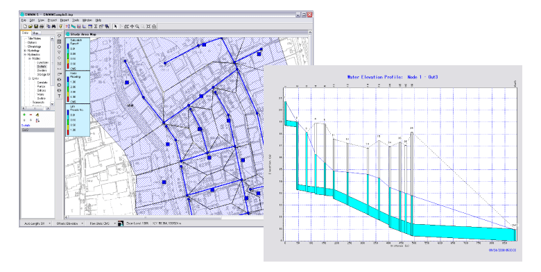
Example 2:Development of a system linking PIPE Design Pro and SWMM5
Example 3:Cloud information collection tool “GEOPRO” using mobile terminals
Example 4:Land replotting plan system (for a land improvement federation)
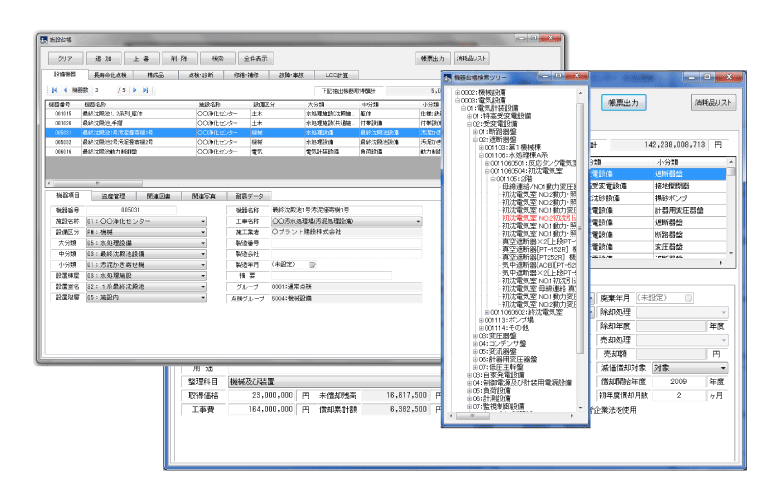
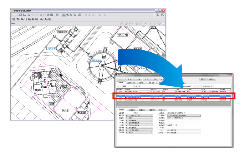
Water and sewage treatment plant facility management system
The system outputs in report format the acquisition date and time, acquisition amount, repair history, and depreciation calculation results for equipment classified as architectural, civil, electrical, mechanical, etc. at treatment plants and water purification plants.
Development of a system linking PIPE Design Pro and SWMM5
SWMM5 handles various processes of urban runoff such as follows.
- Rainfall in time series
- Evaporation of surface water
- Snow accumulation and melting
- Inhibited rainfall due to depression storage
- Infiltration of rainfall into unsaturated soil layers
- Rainfall infiltration into the groundwater layer
- Water flow between groundwater and sewer systems
- Non-linear storage pathways for surface flow
PIPE Design Pro and SWMM5 work together to create stormwater pipe network data in PIPE Design Pro for longitudinal design as follows.Pipe cross section, slope, and pipe bottom height are all given by input or automatic calculation.Select “Export to Analysis Tool” from the menu to create SWMM5 data. Add conditions for runoff analysis and run SWMM5.
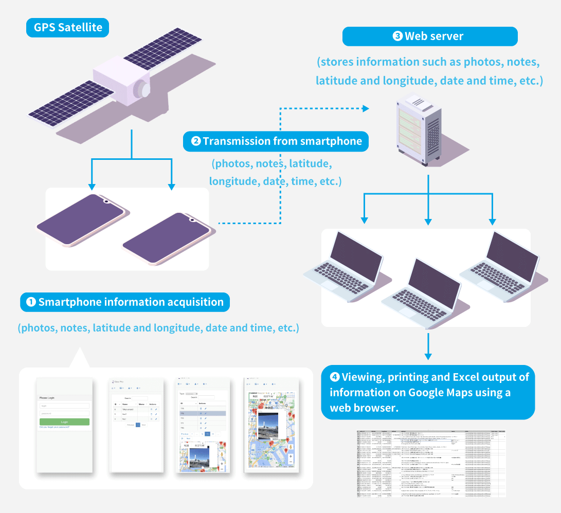
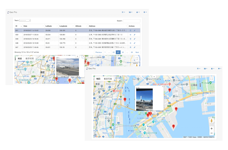
”GEO PRO” Cloud Information Gathering Tool Using Mobile Devices
System Configuration
The purpose of this system is to collect and inspect various data using information terminals and visualize the information by utilizing existing information infrastructure such as GoogleMap and GPS satellites.
Main applications
The system can be used for disaster prevention, road inspections, collection of reports and information from the general public on water supply and sewage systems, and progress management at construction sites.
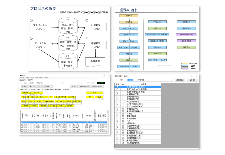
Land Conversion Support System (for Land Improvement Associations)
Issues before introduction
- Difficulty in responding to changes in right holders and landowners.
- Difficulty in transferring information when staff members move.
- Difficulty in managing a small number of staff due to the need to manage highly specialized and diverse information.
- Difficulty in information sharing and coordination among staff members
Advantages of the introduction of the system
- Multiple districts can be managed by a single system.
- Easy coordination with remote areas because information can be centralized through server management
- Easy to confirm and organize information for each right holder.
- Easy to calculate the valuation value of converted land.
- Various forms can be output.